Which route through the Snowy Mountains for March 2015 tour?

User avatar
ozipom
Posts: 94
Joined: Tue Dec 23, 2008 4:35 pm
Location: Maroubra, NSW

Which route through the Snowy Mountains for March 2015 tour?

Postby ozipom » Thu Nov 20, 2014 8:02 pm

I'm currently working on a trip for a couple of weeks for mid-March 2015. I've decided I'm heading back down to the Snowy Mountains and want get off the main roads. I've put together 3 options, but would like a bit of help on deciding which to pick (open to other ideas as well).

Route 1 - Gundagai to Goulburn
Route 2 - Gundagai to Nowra
Route 3 - Bairnsdale to Canberra

All three routes together: The three choices

For both routes 1 & 2 I would get the bus from Sydney to Gundagai. Then head through Batlow, along Elliot Way, join the Snowy Mtn Hwy for a short distance to Yarrangobilly Caves. I then pick up some my dirt roads (Lone Pine, Blue Waterholes FT and Boboyan Road) to take me through the ACT.

Route 1 continues on to Yass and Goulburn where I'll get the bus/train back to Sydney. Route 2 instead heads through to Captains Flat, then to Moruya and follow a combination of quiet roads and Princes Hwy to Nowra. Where I'll get the train home.

Route 3 I'd need to fly to Melbourne and catch the train to Bairnsdale. I'd follow the East Gippsland rail trail to Orbost and head north following the Snowy River Road/Barry Road. After I would go via Dalgety, Adamiaby and then join route 1 & 2 at Yarrangobilly Caves until I get to Canberra. There I'd get the bus home.

All three routes require me to get public transport to the start. Was wondering if anyone has had any experience with the bus down the Hume? As on greyhounds website it says they can take the bike as is (for a few extra $$). I understand they normally have a trailer attached to the bus where you would put your bike?

Flying to Melbourne would of course involve boxing the bike for the flight. Which doesn't bother me, as done that a number of times now without any problems. Looking at V-lines website re the train to Bairnsdale I just need to book myself a seat and role my bike on?

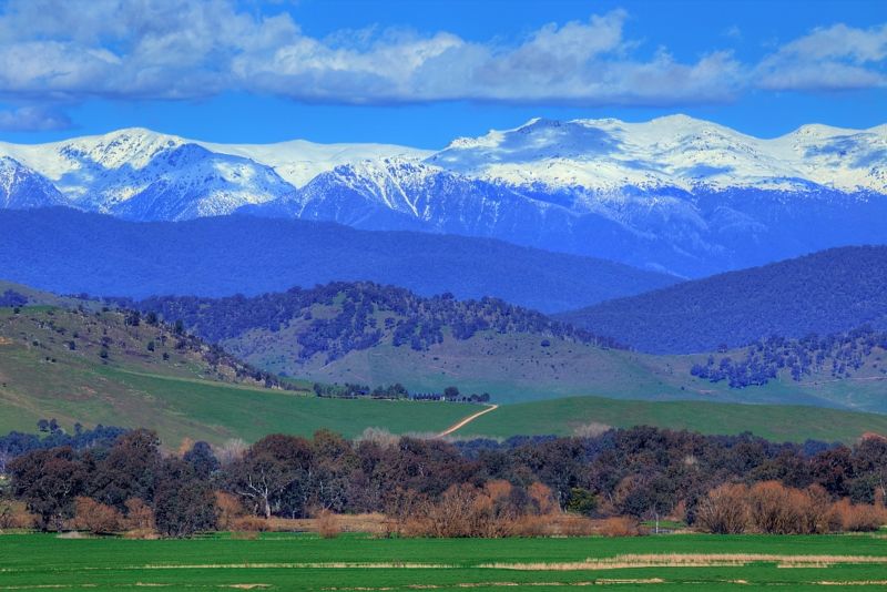
I know all three routes will take me through nice scenery and good campsites. And that there are a few good hills to get over as well :). I was wondering if anyone has rode out this way and would recommend one route over the other or would have any other suggestions which I might have missed.

Thanks in advance :) :) :)
- Brian

Surly Ogre
Avanti Vivace 2009
Long Haul Trucker
Bike Friday - Pocket Llama
Link to my Tours around Australia

User avatar
WarrenH
Posts: 664
Joined: Fri May 28, 2010 3:58 am

Re: Which route through the Snowy Mountains for March 2015 t

Postby WarrenH » Tue Nov 25, 2014 3:47 pm

Brian, G'day Mate.

You have planned some excellent routes, without a doubt. But, I'd like to suggest a few changes to each of the three main routes over the next few days. I'll also locate some ride reports that you may not have seen ... to hopefully enhance your routes. Also if you want to see photos of your three main routes, let me know. Could you not use the Special Note section if you want to contact me, but post here. For some reason I can't reply to Special Notes that I get, which has me stumped. I can reply to Special Notes, but the replies are not reaching the senders.

On the Gundagai to Nowra route, had you considered not starting at Gundagai but starting in Albury? Heading along lake Hume to enter the Alps that way through Corryong. This route is more spectacular, for relatively the same degree of unavoidable hill climbing. The Western Fall Wilderness is beautiful. Plus you'll avoid the timber jinkers around Tumut. There is much logging in and around the State Forests of the Tumut region, it's big logging country. The country is fairly ordinary there too. If the heat keeps coming and the rains don't, it is not that flash being out there.

You will still take in the Yarrangobilly Thermal Pool and swim with the frogs but enter the Reserve from the South. It is only about 3 kilometres to Long Plain from the highway, then to Coolamine, Blue Water Holes and the Murray Gap Trail to enjoy the amazing descent of Lone Pine Fire Trail. Also from Shannons Flat when reaching the ACT Border, consider leaving Boboyan Road just metres past the Border signs (lots of signs here) and join the Bicentennial National Trail at the Burnt Hill Fire Trail. This will join the Naas River Fire Trail along the Naas Valley with several wet crossings to reach Carloola Farm. At the end of the Naas River Valley the road again joins Boboyan Road, via the localities of Naas and Top Naas. There are several high country huts beside the tracks and excellent wild camping from Long Plain to Caloola Farm. There are top camping facilities and cabins at Caloola Farm.

Have you seen SixMaps for the roads and tracks of New South Wales? All the fire trails are named on SixMaps (when the zoom is right). It is an excellent web map.

I'll call back, when I locate a few of the old posts.

Warren.
"But on steep descending...Larson TT have bad effect on the mind of a rider" - MadRider from Suji, Korea 2001.

"Paved roads ... another fine example of wasteful government spending." - a bumper sticker.

User avatar
ozipom
Posts: 94
Joined: Tue Dec 23, 2008 4:35 pm
Location: Maroubra, NSW

Re: Which route through the Snowy Mountains for March 2015 t

Postby ozipom » Tue Nov 25, 2014 7:29 pm

Thanks for the reply Warren

I had considered starting in Albury but decided against it. A few years ago as part of a previous trip I rode along Lake Hume and took the road via Khancoban and then to Thredbo. Even though the ride around Lake Hume was great, I wasn't keen on retracing my steps for the first 150kms. As would prefer to find some new roads I haven't ridden before. But may reconsider if the alternative is average at best.

The option via the Bicentennial trial sounds good. Will investigate that further. I'm looking forward to the wild camping after Long Plain, as been looking at the huts along the tracks. Never heard of Caloola Farm, so will check it out.

I didn't know about SixMaps, looks like a really good resource. Will have a play with it over the next few days.

Thanks again.
- Brian

Surly Ogre
Avanti Vivace 2009
Long Haul Trucker
Bike Friday - Pocket Llama
Link to my Tours around Australia

User avatar
WarrenH
Posts: 664
Joined: Fri May 28, 2010 3:58 am

Re: Which route through the Snowy Mountains for March 2015 t

Postby WarrenH » Tue Nov 25, 2014 8:38 pm

Perhaps you should mentioned where else you have been. So as not to have us waste both of our times.

Well, that was a bad start by me ... now that I know that you know what killed the horse? Mind the gap!

Here's a picy to jog the memory of what we see when first entering the mountains ... from Tooma Road.

Image


Warren.
"But on steep descending...Larson TT have bad effect on the mind of a rider" - MadRider from Suji, Korea 2001.

"Paved roads ... another fine example of wasteful government spending." - a bumper sticker.

User avatar
ozipom
Posts: 94
Joined: Tue Dec 23, 2008 4:35 pm
Location: Maroubra, NSW

Re: Which route through the Snowy Mountains for March 2015 t

Postby ozipom » Tue Nov 25, 2014 9:05 pm

Apologies. Didn't even think about it when I was putting the original post up! In the Snowy region that is the only route I've done. As after Thredbo I headed across to Nowra and then north on the main highway to Canberra. It was my first big trip (Melbourne to Sydney) so I didn't venture very far from the sealed roads. Unlike now where I prefer the dirt and will try and avoid the sealed roads where possible.

After that first tour, I have always wanted to head back that way and explore the region. I've enjoyed reading your journals (great pics by the way) over on CGOAB about the region.
- Brian

Surly Ogre
Avanti Vivace 2009
Long Haul Trucker
Bike Friday - Pocket Llama
Link to my Tours around Australia

User avatar
Leaf T
Posts: 957
Joined: Sat Mar 29, 2008 12:22 pm

Re: Which route through the Snowy Mountains for March 2015 t

Postby Leaf T » Tue Nov 25, 2014 9:53 pm

WarrenH wrote:Perhaps you should mentioned where else you have been. So as not to have us waste both of our times.

Well, that was a bad start by me ... now that I know that you know what killed the horse? Mind the gap!

Here's a picy to jog the memory of what we see when first entering the mountains ... from Tooma Road.

Image


Warren.
Wow! Even on my little netbook that photo is stunning.

Who is online

Users browsing this forum: No registered users